;)
;)
 Archives


|
Wednesday, April 14, 2010, 10:09 PM
Posted by Administrator
We had two items to check off our list before leaving Phoenix:Posted by Administrator
1. Stop by REI to return the waterproof gloves I bought at the Bend REI. Those things didnt even stay dry for one hour of snow shoveling in Mt. Shasta!
2. Enjoy lunch at Picazzos!
;)
We cruised down I-10 and were thrilled to pull into our driveway. Click here for the wonderful greeting we received.
In a nutshell, this trip was AMAZING! Not wanting to take a single day for granted, I often reminded myself that this was a once-in-a-lifetime adventure that holds a spot on many peoples bucket lists. I feel so fortunate to have had the opportunity to enjoy the journey at this point in my life and with an incredible partner.
Thanks for sharing in the journey with us!
add comment
( 13 views )
| 0 trackbacks
| permalink


|
|
|
Monday, April 12, 2010, 09:22 PM
Posted by Administrator
I started the day with a short run followed by a hot springs soak. Doesnt get much better than that.Posted by Administrator
;)
After packing up and hitting the road, our first stop of the day was the China Ranch Date Farm whose dates are sold at the Sunday farmers' market at St. Philips Plaza. I absolutely LOVE them and so was excited to see that the farm was on our route. I was doubly excited when we got there and found that they sell the dates for half the price that I usually get them. We bought 6 pounds for later and a date shake for right then. Mmmm
;)
;)
Our next destination was the Mojave Desert National Preserve, but we made a pit stop in Baker, CA for lunch at the Mad Greek. Youve gotta love a Greek restaurant that sells both gyros and horchata amidst lots of tacky, naked statues. Paul was quite proud.
;)
Baker is also home to the worlds tallest thermometer. Sadly, we didnt have more time to spend in this cultural mecca.
;)
We cruised through the Mojave Desert National Preserve fairly quickly and continued on to the north entrance of Joshua Tree National Park where we caught the sunset and then set up camp at Ryan Campground.
;)
;)
We thought wed be soaking up the desert warmth by this point in our trip but, no. A storm was passing through and, while we curled into little balls in our tent, temperatures dropped into the upper 20s. Here is out frost-covered car the next morning.
;)
;)
We drove up to Keys View for some early morning photography and then warmed up with a 7-mile hike on the Lost Horse Mine trail.
;)
;)
While hiking, we saw a number of these cocoons filled with crawling caterpillars. Fascinating, yet gross.
;)
From there, we drove to the southern end of the park and did the same hike that we did the very first day of our trip. How's that for coming full circle? This time, we were treated to lots of wildflowers!
;)
;)
;)
;)
We had told our house-sitter that we would return the following day, but, driving out of Joshua Tree, we realized that we could actually make it home by mid-evening if we just kept driving. We were dying to see the furkids, but, not wanting to spring our arrival on him with just a few hours notice, we opted to spend our final evening in Phoenix.
While this felt a little silly, we attended an injury prevention talk at a Phoenix running store and actually both got a lot out of it.
|
|
|
|
Sunday, April 11, 2010, 05:03 PM
Posted by Administrator
Seeing that there was some nice color over the mountains when we opened our eyes around 6:00am, we hopped out of the tent and headed for Zabriskie Point. Unfortunately, it was overcast and so we missed out on the spectacular morning colors for which this lookout is famous. But, Paul still got some great shots.Posted by Administrator
;)
;)
From here, we took a drive through Twenty Mule Team Canyon and stopped to hike up some of the hills. The colors are so different than what I'm used to seeing that some of the photos actually look like paintings to me.
;)
;)
Next up was a drive up to Dantes View, supposedly the most scenic viewpoint in Death Valley. It did not disappoint. We could see Badwater one mile below us, as well as mountain peaks one mile above us.
;)
(Note that that is not water in the photo - it is salt.)
As everything we wanted to see was on the way out of the park, we packed up camp, hit the visitor center, grabbed some lunch at Furnace Creek and then began making our way south.
;)
Our first stop was for a hike in Golden Canyon where I decided that school truly is wasted on the young. Geology had never interested me and yet I found it fascinating how the levels of rocks and sediment clearly told a story.
;)
;)
;)
(Again, that's not a beach in the background - it's a salt pan.)
We drove through Artist Drive which has some of the most colorful rocks in Death Valley.
;)
And we stopped at Devils Golf Course which was bizarre and fascinating. This is all salt that was left behind from evaporated water and has now crystallized.
;)
;)
;)
Our final stop might have been the most anticipated of this portion of the trip, Badwater.
;)
Sitting at 282 feet below sea level, it is the lowest point on the continent. We walked out on the large salt pan and marveled at all of the salt!
;)
On the way out of Death Valley, we were treated to some wildflowers. It's amazing that such beautiful things can grow in this climate
;)
;)
That night, we stayed at Delights Hot Springs Resort in the tiny town of Tecopa. Lest you thing we're getting all fancy on you, I should explain that by resort they mean RV and mobile home park.
;)
As tent camping was not permitted, we settled on a motel room and thoroughly enjoyed a hot spring soak before bed.
;)
|
|
|
|
Saturday, April 10, 2010, 12:56 AM
Posted by Administrator
The initial trip planning I had done while in Tucson had only gotten us as far as Yosemite. It was only about a week ago that I sat down at the library in Bend, Oregon to make a plan. It was at this point that I realized Death Valley was right next to Yosemite.Posted by Administrator
In warmer weather, you can take Highway 120 all the way across Yosemite, which puts you in a great spot to enter Death Valley. However, during snow season, which lasts until early summer in Yosemite, the majority of this highway is closed. We had exited the park via the southern route on Highway 41 and now had to continue driving south to go around the Sierra Nevada mountain range and then north again to enter Death Valley. It was a lot of driving, but well worth it. We both quickly fell in love with Death Valley.
Firstly, it was warm! After a few days in Yosemite, the warm breeze here felt amazing. Secondly, the landscape is otherworldly and beautiful. Thirdly, Death Valley has the mystique of being home to the Badwater Ultramarathon, a 135-mile footrace starting at the lowest point in North America and finishing the top of Mt. Whitney, the highest point in the contiguous United States. This race takes place in July, when temperatures regularly exceed 120 degrees.
We made a pit stop in Stovepipe Wells before a short hike in Mosaic Canyon.
;)
;)
Then, another quick stop at the Mesquite Dunes.
;)
;)
And a short walk at Salt Creek which, amazingly, is home to little pup fish.
;)
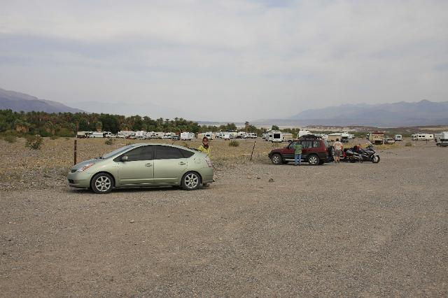
We didnt take too much time as it was already early evening and we were worried about finding camping spot. The month of April is the end of Death Valleys peak tourist season. Sure enough, the Furnace Creek Campground was full, but, just past the town, we found plenty of spots at Sunset Campground which was free!
There is so much to see in Death Valley that you really dont want to spend time at your campsite. This is a good thing as all of the campgrounds are essentially huge gravel parking lots.
Setting up camp was a challenge in the strong winds, but I was so thrilled with the warmth that I didnt care. We didnt even put on the rain fly. We sat in the car to enjoy our dinner chili, salmon and tortillas again and then walked down the road to Furnace Creek to check out the town.
|
|
|
|
Friday, April 9, 2010, 12:23 AM
Posted by Administrator
It was a beautiful clear day, but we spent a while relaxing in the dining hall until it warmed up to a reasonable temperature. Then, we drove to the historic Ahwahnee Lodge to admire the architecture, as well as the waterfall that ended just outside their parking lot.Posted by Administrator
;)
;)
Next, we tackled the Upper Falls Trail of Yosemite Falls. While I knew it was a 7.6-mile hike with 2,600 feet of elevation gain, I truly did not appreciate how tough it would be. I got my first hint when the trail began with 60 switchbacks in the first mile. Yes, 60.
At the half-way point, I was rewarded with a gorgeous view of the upper falls.
;)
Then, the real challenge began. The trail remained just as steep, but now there was also snow. Lots of snow. Luckily, it was soft and previous hikers had paved the way to some degree, but it was a slow slog.
Paul went ahead, so that he could take his time with photos, but also because I was unsure whether I would make it to the top. I had never hiked through snow before and wasnt sure how I or my boots would hold up.
;)
There were a few points when I considered whether I should continue, but then would look up and see how close I was getting to the top. At one point, I stopped a descending hiker to ask how close I was. He gave me some encouragement along with instructions regarding a confusing trail sign. Explaining that, once at the top, you can descend slightly to an overlook with a railing, he said, Dont stop until youre hanging over the railing! This became a kind of mantra for the remainder of my hike.
;)
Very close to the top, the snow became quite deep and I stopped to put on an extra layer. It had turned quite warm by this point and I had stripped down to just a t-shirt. I got a little off the trail at one point and had to post-hole my way over to the real trail with the snow coming up past my knees.
Paul had given me a 50/50 chance of making it and so he was quite happy to see me at the top. He led me down to the overlook and it was gratifying to see how far I had come.
;)
;)
It had taken us 3 hours for the ascent and would take another 2 hours to get back down. I was dismayed by the large number of ill-prepared hikers I encountered people wearing tennis shoes and not carrying supplies of any kind.
As a childless adult, I make it a general rule not to judge parents. However, I seriously wondered if CPS should be called on the parents who were dragging their kids up this mountain. I saw kids who must have been as young as 5 years old slipping and falling on the narrow, snow-covered trail.
We arrived back at Yosemite Village dirty, hungry and, in Pauls case, slightly injured. He had slipped and dislocated his thumb which was swollen for a few hours and sore for a few days. But, we were pleased with our epic hike.
While we had planned to spend one more night at Yosemite, we determined that we had really seen all that we could. There were other areas of the park, but they were closed until late May or early June - whenever the snow melts. We decided to check out early and enjoy the luxury of a warm hotel room in Fresno. It was heavenly.
|
|